Land Entitlement Intelligence
Know what a site yields, and how the city actually decides — before the LOI.
Read the zoning, comp plan, and Planning Commission record for any parcel — then see the highest-and-best-use yield and the land residual it supports.
350K
Parcels analyzed
2,900
Planning Commission projects read
240K
eCRV sale records
18
Counties covered
The difference
Most tools stop at the zoning map. We read the meetings.
TRACT extracts the Planning Commission record across 38 Minnesota cities — every project, vote, and condition of approval. So you see not just what’s allowed, but what actually gets approved here.
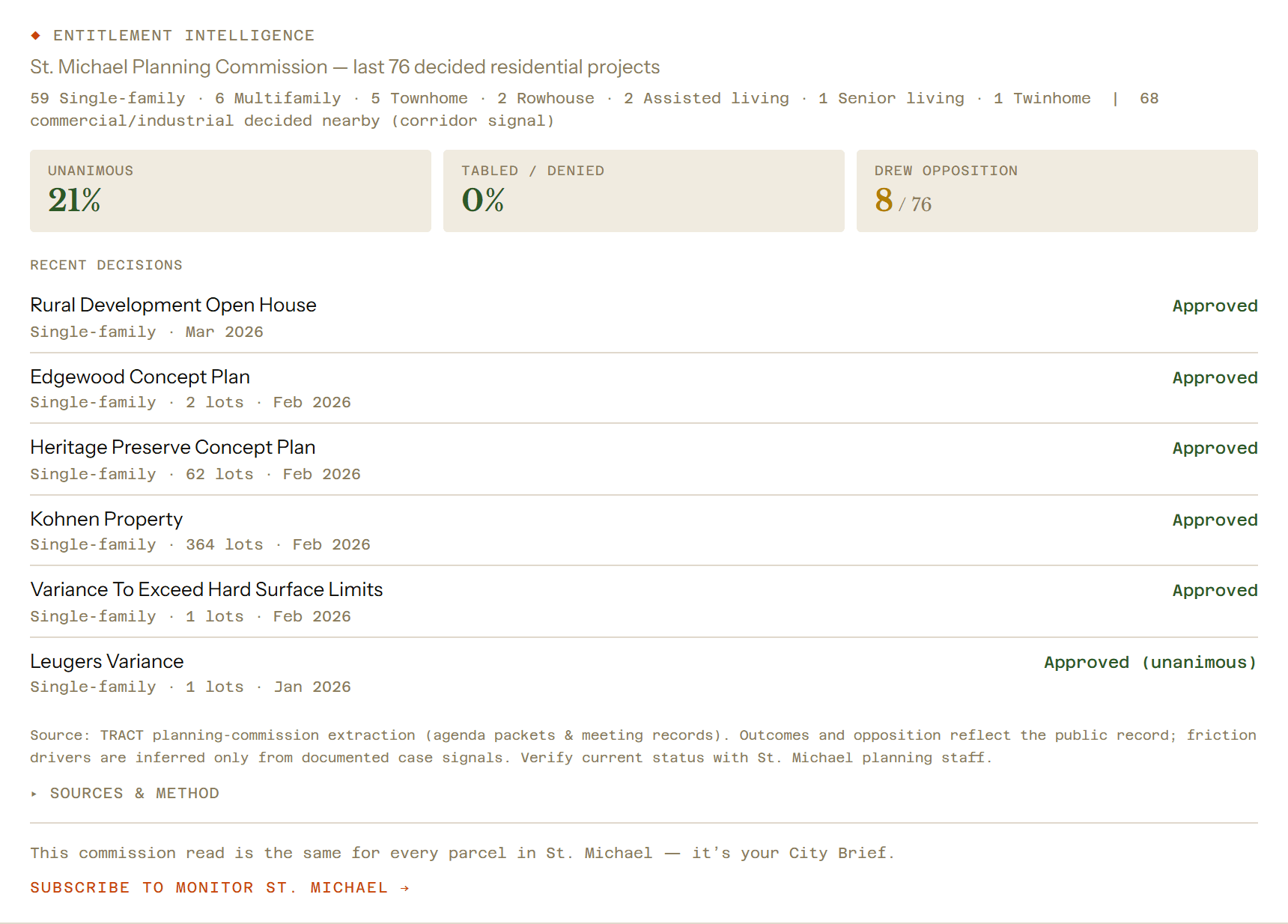
- ◆Approval track record — Per-city unanimous, tabled, and denied rates.
- ◆Friction & opposition — Which projects stalled, and the documented reasons.
- ◆Commissioner patterns — Who sits on the commission and how votes land.
Sourced from public agenda packets, minutes & meeting video. Independently verifiable.
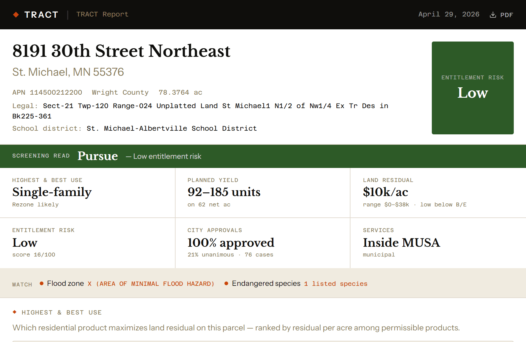
The TRACT Report
One document. The whole entitlement picture.
Every report leads with a verdict, then walks the decision a land team actually makes.
Verdict & bottom line
Entitlement-risk read at a glance, plus the one line a partner needs.
Highest & best use
Per-product yield and land residual, capped to the planned density.
Entitlement intelligence
This city’s approval track record, recent decisions, and friction.
Constraints
Flood, wetlands, MUSA, infrastructure — surfaced only when relevant.
Site economics
Fees, the cost stack, and the residual math — every input labeled.
Comparable transactions
eCRV land and finished-lot comps for the market.
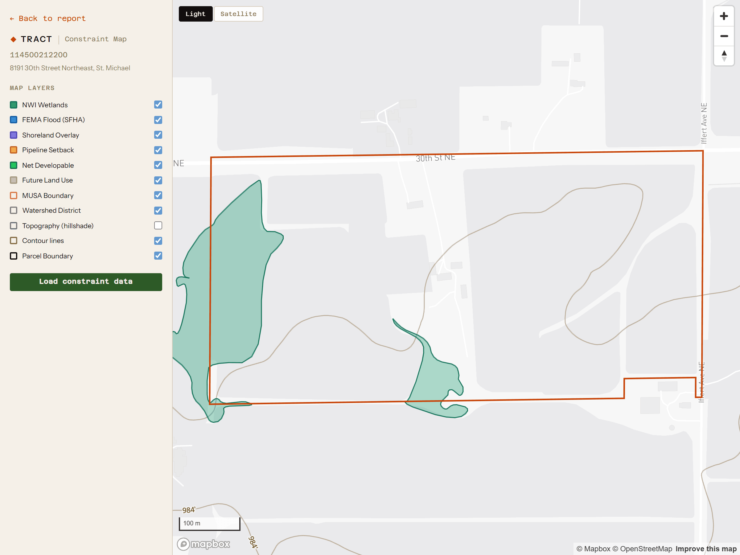
Every constraint, on one map — flood, wetland, and service boundaries.
Built for the people who underwrite land
Land developers
Underwrite the entitlement before you tie up the dirt — yield, residual, and the city’s track record.
Homebuilders
Vet lot yield and commission friction before the land team commits to a site.
Land brokers
Screen listings fast and bring sellers a credible, defensible read.
How it works
From address to underwriting, in two clicks.
Address, parcel ID, or coordinates.
Verdict, risk flags, and headline yield in seconds. No card.
The full TRACT Report, unlocked instantly — $79.
Pricing
Screen for free. Pay for the deep read.
The screen is always free. When a parcel earns a closer look, the report is one flat price — or subscribe for volume.
TRACT Report
$79
per parcel · full report · unlocks instantly
- ◆Verdict + highest & best use
- ◆Entitlement intelligence
- ◆Constraints + site economics
- ◆Comparable transactions
- ◆Downloadable PDF
Subscription
$199/mo
10 TRACT Reports + unlimited screens
Enterprise / division pricing — ben@tractinsight.com.
Screen your next parcel.
Verdict, risk flags, and headline yield in seconds — free.